|
| 編輯推薦: |
|
给出了非洲较完整的体系化清洁能源资源评估方法与结果,提出了基地开发方案,并且展示了量化的技术经济指标,对于读者而言兼顾科普性、通识性以及专业性,满足不同读者的信息获取需求。
|
| 內容簡介: |
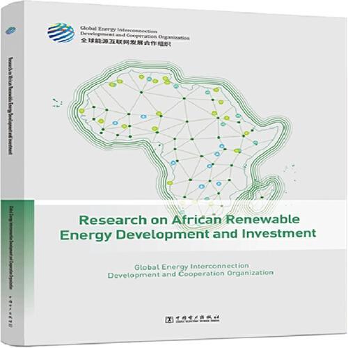
本报告是《非洲清洁能源开发与投资研究》的英文版。
本报告是聚焦非洲清洁能源开发与投资研究,全面展示了非洲的清洁能源资源评估和大型基地选址成果。第1章至第3章,采用数字化方法完成了非洲水电、风电和光伏的资源评估与基地开发研究。在水电方面,对非洲主要流域的水能资源开展了理论蕴藏量测算,对主要待开发的河段提出了梯级开发方案;在风电和光伏方面,在全面测算和分析影响集中式开发的主要影响因素基础上,开展了全洲各国家和地区风能、太阳能理论蕴藏量、技术可开发量以及开发成本的量化评估。运用数字平台,研究提出了非洲大型陆上风电基地、大型太阳能光伏基地的选址布局,完成了开发条件评价、开发规模评估以及技术经济指标测算。第4章,基于非洲能源电力供需发展趋势,统筹区域内、跨区及跨洲电力消纳市场,研究分析大型清洁能源基地送电方向和输电方式。第5章,梳理了非洲主要国家的能源政策及投资现状,剖析清洁能源开发项目典型投资模式,结合非洲水能、风能、太阳能大型基地开发方案开展案例研究,提出了加快非洲清洁发展的政策和投资模式建议。
|
| 關於作者: |
|
全球能源互联网发展合作组织(简称合作组织),是由致力于推动世界能源可持续发展的相关企业、组织、机构和个人等自愿组成的国际组织。注册地设在北京。合作组织的宗旨是推动构建全球能源互联网,以清洁和绿色方式满足全球电力需求,推动实现联合国“人人享有可持续能源”和应对气候变化目标,服务人类社会可持续发展。合作组织将积极推广全球能源互联网理念,组织制定全球能源互联网发展规划,建立技术标准体系,开展联合技术创新、重大问题研究和国际交流合作,推动工程项目实施,提供咨询服务,引领全球能源互联网发展。
|
| 目錄:
|
PREFACE STUDY REGION SUMMARY
Hydroenergy Resources Assessment and Development 001
1.1Methods and Data 002
1.1.1Resource Assessment Methods 002
1.1.2Macro Site Selection Method 004
1.1.3Basic Data and Parameters 006
1.2Resources Assessment 010
1.2.1Distribution of Water Systems 010
1.2.2Hydrological Data 012
1.2.3Land Covers 016
1.2.4Geological Conditions 017
1.2.5Overview of Hydroenergy Resources 020
1.2.6Assessment Results 023
1.3Power Bases Development 038
1.3.1Development Status 038
1.3.2Layout of Bases 040
1.3.3Base on Congo River 042
1.3.4Base on Zambezi River 055
1.3.5Nile River Base 069
1.3.6Niger River Base 076
Wind Energy Resources Assessment and Development 079
2.1Methods and Data 080
2.1.1Resource Assessment Methods 080
2.1.2Macro Site Selection Method 084
2.1.3Basic Data and Parameters 086
2.2Resources Assessment 092
2.2.1Distribution of Wind Speeds 092
2.2.2Land Covers 094
2.2.3Distribution of Conservation Areas 095
2.2.4Transportation Facilities 096
2.2.5Grid Facilities 097
2.2.6Assessment results 099
2.3Power Bases Development 110
2.3.1Development Status 110
2.3.2Layout of Bases 111
2.3.3Overview of Bases 112
2.3.4Study on Site Selection of Bases 117
Solar Energy Resources Assessment and Development 127
3.1Method and Data 128
3.1.1Resource Assessment Method 128
3.1.2Macro Site Selection Method 130
3.1.3Basic Data and Parameters 132
3.2Resources Assessment 137
3.2.1Distribution of Global Horizontal Irradiance 137
3.2.2Distribution of Land Covers 138
3.2.3Distribution of Terrains 140
3.2.4Assessment results 142
3.3Power Bases Development 153
3.3.1Development Status 153
3.3.2Layout of Bases 154
3.3.3Overview of Bases 155
3.3.4Study on Site Selection of Base 161
Outbound Transmission of Large Renewable Energy Bases 171
4.1Power Demand Forecast 172
4.2Deep Electric Energy Substitution 176
4.2.1Hydrogen Production and Hydrogen Energy Utilization for Clean Electricity... 176
4.2.2Seawater Desalination and Ecological Restoration 179
4.3North Africa 181
4.3.1Power Delivery Direction 181
4.3.2Power Transmission Mode 182
4.4West Africa 184
4.4.1Power Delivery Direction 184
4.4.2Power Transmission Mode 185
4.5Central Africa 186
4.5.1Power Delivery Direction 186
4.5.2Power Transmission Mode 187
4.6East Africa 190
4.6.1Power Delivery Direction 190
4.6.2Power Transmission Mode 191
4.7Southern Africa 193
4.7.1Power Delivery Direction 193
4.7.2Power Transmission Mode 194
Policy Environment and Investment and Financing Suggestions 197
5.1Overview of Countries in Africa 198
5.2Policy Environment for Key African Countries 201
5.2.1Egypt 201
5.2.2Morocco 203
5.2.3Guinea 205
5.2.4Nigeria 207
5.2.5Tanzania 209
5.2.6Namibia 211
5.2.7Kenya 213
5.2.8D.R. Congo 215
5.2.9Zambia 217
5.2.10Ethiopia 219
5.2.11South Africa 221
5.3Investment and Financing Proposal 223
5.3.1Innovating the “Electricity-Mining-Metallurgy-Manufacturing-Trade”
Joint Investment and Financing 223
5.3.2Making Full Use of Funds from International Development Financial Institutions... 223 5.3.3Innovating the Guarantee Mode 224
5.3.4Promoting the Power Consumption 224
5.3.5Strengthening the Investment and Financing Risk Prevention 225
5.4Summary 226
EPILOGUE 227
LISTOF FIGURES
Figure 1-1Technical Roadmap for Assessment of Hydropower Generation Capacity 003
Figure 1-2Technical Roadmap for Digital Macro Site Selection 004
Figure 1-3Digital Macro Site Selection Process for Hydropower Bases 005
Figure 1-4Distribution of Major Rivers in Africa 010
Figure 1-5Distribution of Major Hydrological Stations in Africa 013
Box 1-2 Figure 1Distribution of Global Annual Runoff Depths 014
Box 1-2 Figure 2Flow Data of Kinshasa Hydrological Station 015
Figure 1-6Distribution of Cultivated Lands and Urban Areas in Africa 017
Figure 1-7Distribution of Major Geological Faults and Historical Seismic Activity
Frequency in Africa 018
Figure 1-8Distribution of Major Rock Types in Africa 019
Figure 1-9Distribution of Nine Major River Basins in Africa 021
Figure 1-10Distribution of Theoretical Potential of Major Rivers in Congo River Basin 024
Figure 1-11Distribution of Theoretical Potential of Main Rivers in Nile River Basin 028
Figure 1-12Distribution of Theoretical Potential of Major Rivers in the Zambezi River 030
Figure 1-13Distribution of Theoretical Potential of Main Rivers in Niger River Basin 032
Figure 1-14Installed Capacities of Hydropower in Africa 039
Figure 1-15General Layout of Large-scale Hydropower Bases in Africa 040
Figure 1-16Locations of Cascade Hydropower Stations in Mainstream Reach of Luvua River 044
Figure 1-17Longitudinal Section of Luvua River Cascade Hydropower Stations 044
Figure 1-18 Figure 1-18 Locations of Cascade Hydropower Stations in Lower Reaches lelow Kinshasa of Congo River 045
Figure 1-19Longitudinal Section of Cascade Hydropower Stations in Lower Reaches of
Congo River 046
Figure 1-20Distribution of Major Land Covers in Reservoir Area of Pioka Hydropower Station 049
Figure 1-21Distribution of Main Conservation Areas Around Pioka Hydropower Station 050
Figure 1-22Distribution of Main Strata Around Pioka Hydropower Station 050
Figure 1-233D Effect Diagram of Pioka Hydropower Station Project 051
Figure 1-24Distribution of Major Land Covers in Reservoir Area of Matadi Hydropower Station 052
Figure 1-25Distribution of Main Conservation Areas Around Matadi Hydropower Station 053
Figure 1-26Distribution of Main Strata Around Matadi Hydropower Station 053
Figure 1-273D Effect Diagram of Matadi Hydropower Station Project 054
Figure 1-28 Longitudinal Section of Cascade Hydropower Stations in Sitoti-Katima Mulilo Reach 057
Figure 1-29Longitudinal Section of Cascade Hydropower Stations in Kazungula-Deka
Town Reach 058
Figure 1-30Longitudinal Section of Cascade Hydropower Stations in Deka Town-Songo
Village Reach 059
Figure 1-31Longitudinal Section of Cascade Hydropower Stations in Songo Village-Bandar
Village Reach 059
Figure 1-32Distribution of Major Land Covers in Reservoir Area of Songo Hydropower Station 064
Figure 1-33Distribution of Main Strata Around Songo Hydropower Station 065
Figure 1-34The 3D Effect Diagram of the Songo Hydropower Station Project 066
Figure 1-35Distribution of Major Land Covers in Reservoir Area of Tete Hydropower Station 067
Figure 1-36Distribution of Main Strata Around Tete Hydropower Station 067
Figure 1-373D Effect Diagram of Tete Hydropower Station Project 068
Figure 1-38Longitudinal Section of Cascade Hydropower Stations in Kagera Reach 070
Figure 1-39Longitudinal Section of Cascade Hydropower Stations in Upper Victoria Nile River 071
Figure 1-40Longitudinal Section of Cascade Hydropower Stations Lower Victoria Nile Reach 072
Figure 1-41Longitudinal Section of Cascade Hydropower Stations in White Nile Reach 072
Figure 1-42 Longitudinal Section of Cascade Hydropower Stations in Siguiri-Sendo Village reach 077
Figure 1-43Longitudinal Section of Cascade Hydropower Stations in Ansongo-Boumba reach 077
Figure 2-1Assessment Process of Technical Potential Installed Capacity of Wind Power 081
Figure 2-2Assessment Process of Economic Potential Installed Capacity Based on LCOE 083
Figure 2-3Grid Integration Cost Composition of Wind Power Development 084
Figure 2-4Macro Site Selection Process of Wind Power Farms 085
Box 2-1 Figure 1Scenario of Centralized Wind Power Development 087
Box 2-1 Figure 2Scenario of Distributed Wind Power Development 088
Figure 2-5Distribution of Wind Speeds in Africa 092
Figure 2-6Distribution of Forests, Cultivated Lands, Wetland Water Bodies, Urban Areas and
Ice and Snow in Africa 094
Figure 2-7Distribution of Main Conservation Areas in Africa 095
Figure 2-8Distribution of High Ways and Railways in Africa 096
Figure 2-9Thermal Distribution of Power Grid Facilities in Africa 099
Figure 2-10Distribution of Africa’s Wind Power Technical Available Areas and Their
Full-load Hours 101
Figure 2-11Distribution of Wind Power Development Costs in Africa 102
Box 2-4 Figure 1Distribution of Wind Power Technical Potential Installed Capacity in Sudan 104
Box 2-5 Figure 1Distribution of Wind Power Technical Potential Installed Capacity and
Development Cost in Kenya 106
Figure 2-12Installed Capacity of Wind Power in Africa 111
Figure 2-13Layout of Large-scale Wind Power Bases in Africa 112
Figure 2-14Distribution of Wind Speeds in Red Sea Wind Power Base 117
Figure 2-15Site Selected for Red Sea Wind Power Base 118
Figure 2-16Stratum Distribution and Seismic History of Red Sea Wind Power Base 119
Figure 2-17Distribution of Annual Wind Power Generation and Thermal Distribution of
8760 Hourly Output Coefficient of Red Sea Wind Power Base 119
Figure 2-18 Wind Direction Rose Map and Weibull Wind Speed Distribution Chart of Red Sea Wind Power Base 120
Figure 2-19Daily and Annual Variation Curves of Typical Wind Speed and Wind Power
Density in Red Sea Wind Power Base 120
Figure 2-20Typical Daily and Annual Output Curves of Red Sea Wind Power Base 120
Figure 2-21Wind Turbine Layouts in Some Areas of Red Sea Wind Power Base 121
Figure 2-22Distribution of Wind Speeds in North Horr Wind Power Base 122
Figure 2-23Site Selected for North Horr Wind Power Base 123
Figure 2-24Stratum Distribution and Seismic History of North Horr Wind Power Base 123
Figure 2-25Distribution of Annual Wind Power Generation and Thermal Distribution of
8760 Hourly Output Coefficient of North Horr Wind Power Base 124
Figure 2-26Wind Direction Rose Map and Weibull Wind Speed Distribution Chart of
North Horr Wind Power Base 125
Figure 2-27Daily and Annual Variation Curves of Typical Wind Speed and Wind Power
Density in North Horr Wind Power Base 125
Figure 2-28Typical Daily and Annual Output Curves of North Horr Wind Power Base 125
Figure 2-29Wind Turbine Layouts in Some Areas of North Horr Wind Power Base 126
Figure 3-1Assessment Process for Technical Potential Installed Capacity of Solar
Photovoltaic Generation 129
Figure 3-2Macro Site Selection Process of Photovoltaic Power Farms 131
Box 3-1 Figure 1Centralized Plain Photovoltaic Power Station 133
Box 3-1 Figure 2Centralized Hilly Photovoltaic Power Station 134
Box 3-1 Figure 3Distributed Photovoltaic Development 134
Figure 3-3Distribution of Global Horizontal Irradiance of Solar Energy in Africa 137
Figure 3-4Distribution of Herbaceous Vegetation, Shrubs and Bare Grounds in Africa 139
Figure 3-5Distribution of Altitudes in Africa 140
Figure 3-6Distribution of Terrain Slopes in Africa 141
Figure 3-7Distribution of Technical Available Areas for Photovoltaic Generation in Africa and
Their Full-load Hours 143
Figure 3-8Distribution of Development Costs for Photovoltaic Generation in Africa 145
Box 3-4 Figure 1Distribution of Technical Potential Installed Capacity and Development
Costs of Photovoltaic Generation in Namibia 147
Box 3-5 Figure 1Distribution of Technical Potential Installed Capacity and Development
Costs of Photovoltaic Generation in Egypt 149
Figure 3-9Installed Photovoltaic Capacity in Africa 153
Figure 3-10Layout of Large-scale Photovoltaic Power Bases in Africa 154
Figure 3-11Distribution of Solar GHI in Karasburg Photovoltaic Power Base 161
Figure 3-12Site Selected for Karasburg Photovoltaic Power Base 162
Figure 3-13Stratum Distribution and Seismic History of Karasburg Photovoltaic Power Base 163
Figure 3-14Distribution of Annual Power Generation and Thermal Distribution of 8760 Hourly
Output Coefficient of Karasburg Photovoltaic Power Base 163
Figure 3-15Typical Daily and Annual Variation Curves of Irradiance and Temperature of
Karasburg Photovoltaic Power Base 164
Figure 3-16Typical Daily and Annual Output Curves of Karasburg Photovoltaic Power Base 164
Figure 3-17Layout of Modules of Karasburg Photovoltaic Power Base 165
Figure 3-18Distribution of Solar GHI in Minya Photovoltaic Power Base 166
Figure 3-19Site Selected for Minya Photovoltaic Power Base 167
Figure 3-20Stratum Distribution and Seismic History of Minya Photovoltaic Power Base 167
Figure 3-21Distribution of Annual Photovoltaic Generation and Thermal Distribution of
8760 Hourly Output Coefficient of Minya Photovoltaic Power Base 168
Figure 3-22 Typical Daily and Annual Variation Curves of Irradiance and Temperature of Minya Photovoltaic Power Base 169
Figure 3-23Typical Daily and Annual Output Curves of Minya Photovoltaic Power Base 169
Figure 3-24Layout of Modules of Minya Photovoltaic Power Base 170
Figure 4-1Change Trend of Electricity Demand in North Africa 172
Figure 4-2Change Trend of Electricity Demand in West Africa 173
Figure 4-3Change Trend of Electricity Demand in Central Africa 174
Figure 4-4Change Trend of Electricity Demand in East Africa 174
Figure 4-5Change Trend of Electricity Demand in Southern Africa 175
Box 4-1 Figure 1Schematic Diagram of Matching Hydrogen Production by Electricity with New Energy Power Generation 178
Box 4-3 Figure 1Schematic diagram of reverse osmosis seawater desalination technology 180
Figure 4-6Schematic Diagram of Long-run Transmission Scheme for Renewable Energy Bases in North Africa 183
Figure 4-7Schematic Diagram of Long-run Transmission Scheme for Renewable Energy Bases in West Africa 185
Figure 4-8 Schematic Diagram of Long-run Inter-regional Power Transmission Scheme for Congo River Hydropower Base 188
Figure 4-9 Schematic Diagram of Long-run Transmission Scheme for Renewable Energy Bases in Central Africa 189
Figure 4-10Schematic Diagram of Long-run Transmission Scheme for Renewable Energy Bases in East Africa 192
Figure 4-11 Schematic Diagram of Long-run Transmission Scheme for Renewable Energy Bases in Southern Africa 196
Figure 5-1Overview of Egypt’s Policy 201
Figure 5-2Overview of Morocco’s Policy 203
Figure 5-3Overview of Guinea’s Policy 205
Figure 5-4Overview of Nigeria’s Policy 207
Figure 5-5Overview of Tanzania’s Policy 209
Figure 5-6Overview of Namibia’s Policy 211
Figure 5-7Overview of Kenya’s Policy 213
Figure 5-8Overview of D.R. Congo’s Policy 215
Figure 5-9Overview of Zambia’s Policy 217
Figure 5-10Overview of Ethiopia’s Policy 219
Figure 5-11Overview of South Africa’s Policy 221
LISTOF TABLES
Table 1-1Basic Data on Global Water Resources and Geographic Information 006
Table 1-2Main Technical Indicators and Parameters Used in Assessment Model of Global Hydroenergy Resources 008
Table 1-3Recommended Values of Financial Parameters for Economic
Calculation of Hydropower Development in Africa 009
Table 1-4Reference Values for Tax Rate Information of main Hydropower Development Countries
in Africa 009
Table 1-5Comparison of Runoff Discharge Data of Rivers in Africa 016
Table 1-6Theoretical Potential of Hydroenergy Resources of Nine River Basins by Country
in Africa 022
Table 1-7Theoretical Potential of Hydroenergy Resources of Nine River Basins by Country
in Africa 022
Table 1-8Theoretical Potential of Main Stream and Main Tributaries of Congo River 025
Table 1-9River Length and Theoretical Basin Potential of Congo River by Country 026
Table 1-10Theoretical Potential of Main Stream and Tributaries of Nile River 028
Table 1-11River Length and Theoretical Basin Potential of Nile by Country 029
Table 1-12Theoretical Potential of Main Stream and Main Tributaries of the Zambezi River 031
Table 1-13River Length and Theoretical Basin Potential of Zambezi by Country 031
Table 1-14Theoretical Potential of Main Stream and Main Tributaries of the Niger River 033
Table 1-15River Length and Theoretical Potential of Niger Basin by Country 034
Table 1-16Theoretical Potential of Main Stream and Main Tributaries of the Sanaga River 035
Table 1-17Theoretical Potential of Main Stream and Main Tributaries of the Ogooué River 035
Table 1-18Theoretical Potential of Main Stream and Main Tributaries of the Cuanza River 036
Table 1-19Theoretical Potential of Main Stream and Main Tributaries of the Volta River 037
Table 1-20Theoretical Potential of Main Stream and Main Tributaries of the Rufiji River 037
Table 1-21Hydropower Development in Major African Countries in 2018 039
Table 1-22Indicators of Hydroenergy Resources in Four Major River Basins of Africa 041
Table 1-23 Technical Indicators for Cascade Development of Large Hydropower Bases in Africa 041
Table 1-24Theoretical Hydropower Potential in Main Stream of Congo River by Reaches 042
Table 1-25Main Technical Indicatorsfor Development Scheme of Cascade Hydropower
Stations in Congo River Main Stream Reach 047
Table 1-26Theoretical Hydroenergy Potential in Main Stream of Zambezi River by Reaches 056
Table 1-27Main Indicators for Development Scheme of Cascade Hydropower Stations in
Middle and Upper Reach of Zambezi River 060
Table 1-28Main Indicators for Development Scheme of Cascade Hydropower Stations in
Middle and Upper Reach of Zambezi River 061
Table 1-29Main Technical Indicators for Development Scheme of Cascade
Hydropower Stations in Middle and Lower Reach of Zambezi 063
Table 1-30Main Technical Indicators for Development Scheme of Cascade Hydropower
Stations in Kagera Main Stream and Victoria Nile reaches 073
Table 1-31Main Technical Indicators for Development Scheme of
Cascade Hydropower Stations in White Nile Reach 075
Table 1-32Main Technical Indicators for Development Scheme of
Cascade Hydropower Stations in Niger River Main Stream Reach 078
Table 2-1Basic Data on Global Wind Energy Resources and Geographic Information 086
Table 2-2Main Technical Indicators and Parameters Used in
Assessment Model of Global Wind Energy Resources 089
Table 2-3Composition and Recommended Values of Initial Investment for
On-shore Wind Power Development in Africa by 2035 090
Table 2-4Recommended Values of Financial Parameters for Economic
Calculation of On-shore Wind Power Generation in Africa by 2035 091
Table 2-5Recommended Values of Economic Parameters for On-shore Wind Power
Generation and Grid Integration in Africa by 2035 091
Table 2-6Construction of AC and DC Lines with Different Voltage Levels in Africa 097
Box 2-4 Table 1Measurement and Calculation Results of Main
Conservation Area Coverage in Sudan 103
Box 2-4 Table 2Analysis Results of Main Land Covers in Sudan 103
Box 2-5 Table 1Measurement and Calculation Results of Main
Conservation Area Coverage in Kenya 105
Box 2-5 Table 2Analysis Results of Main Land Covers in Kenya 105
Table 2-7Assessment Results of Wind Energy Resources in 57 African Countries and Regions 107
Table 2-8Wind Power Development in Major African Countries in 2018 110
Table 2-9Technical and Economic Indicators of Major Large-scale Wind Power Bases in Africa 116
Table 2-10Investment Calculation for Red Sea Wind Power Base 121
Table 2-11Investment Calculation for North Horr Wind Power Base 126
Table 3-1Basic Data on Global Solar Energy Resources and Geographic Information 132
Table 3-2Main Technical Indicators and Parameters Used in Assessment Model of Global
Solar Energy Resources 135
Table 3-3Composition and Recommended Values of Initial Investment for
Photovoltaic Development in Africa in 2035 136
Table 3-4Recommended Values of Financial Parameters for Economic Calculation of
Photovoltaic Power Generation in 2035 in Africa 136
Box 3-4 Table 1Measurement and Calculation Results of Major Conservation
Area Coverage in Namibia 146
Box 3-4 Table 2Analysis Results of Main Land Covers in Namibia 146
Box 3-5 Table 1Measurement and Calculation Results of Main Conservation
Area Coverage in Egypt 148
Box 3-5 Table 2Analysis Results of Main Land Covers in Egypt 148
Table 3-5Assessment Results of Solar Energy Resources in 57 African Countries and Regions 150
Table 3-6Photovoltaic Development in Major African Countries in 2018 153
Table 3-7Technical and Economic Indicators of Major Large-scale Photovoltaic Power Bases in Africa 160
Table 3-8Investment Calculation of Karasburg Photovoltaic Power Base 165
Table 3-9Investment Calculation of Minya Photovoltaic Power Base 170
Table 4-1Power Delivery Direction of Large Renewable Energy Bases in North Africa 181
Table 4-2Power Delivery Direction of Large Renewable Energy Bases in West Africa 184
Table 4-3Power Delivery Direction of Congo River Hydropower Base 186
Table 4-4Power Delivery Direction of Large Renewable Energy Bases in East Africa 190
Table 4-5Power Delivery Direction of Large Renewable Energy Bases in Southern Africa 193
|
| 內容試閱:
|
|
Energy is an important material basis for economic and social development. The use of energy by mankind, from firewood to fossil energy such as coal, oil, and natural gas, to power generation from renewable energy such as hydro, wind and solar energy, every change is accompanied by a huge leap in productivity and major progress in human civilization. Energy, as the driving force for the development of modern society, is related to the national economy and people’s livelihood, as well as to human welfare. The massive development and useof traditional fossil energy have led to increasingly prominent problems such as resource shortages, environmental pollution, and climate change, which seriously threaten human survival and sustainable development. In essence, the core of sustainable development is clean development. The key is to promote clean replacement on the energy production side, and replace fossil energy with renewable energy such as solar, wind, and hydropower.Research on scientific and accurate quantitative assessment of resources is an importantbasis foundation for large-scale development and utilization of renewable energy. At present, the global installed capacity of hydro, wind and solar power has exceeded 30% of the total installed capacity of power sources. Although some achievements have been made in the development of renewable energy, there is still huge potential to be developed urgently. Therefore, it is of great importance to conduct a fine assessment on the resource reserves. On the basis of establishing and improving the global renewable energy resources database, the Global Energy Interconnection Development and Cooperation Organization GEIDCO has established an assessment system and digital fine assessment models of renewable energy resources, carried out systematic calculation and quantitative assessment of theoretical potential, technical potential installed capacity and economic potential installed capacity of hydro, wind and solar energies from a global perspective. An achievement of the Global Renewable-energy Exploitation ANalysis platform GREAN has been made, thereby the accuracy and timeliness of global renewable energy resources assessment will be effectively improved, which provides important support for large-scale development and utilization of renewable energy in relevant countries and regions.Research on systematic and efficient macro site selection of power bases is an important prerequisite for large-scale development and utilization of renewable energy. The site selection of renewable energy power bases is related to the economy of power station development, which is crucial to the large-scale economic development and efficient utilization of renewable energy. There are many factors affecting the site selection of power bases, hence the site selection analyses and decision-making process are complicated and difficult. The desk top study of site selection is often limited by the integrity and accuracy of data. Site selection must rely on site survey, which consumes a huge amount of manpower,financial resources and time costs. By taking into account such factors as global topography and terrain elevation, land covers, water systems, natural reserves, geology and historical seismic activity frequency, power supply and power grid, population and economy, GEIDCO has developed models and tools for macro site selection of renewable energy power bases which significantly increase the breadth and depth of data collection and analysis processes, thus greatly improving the accuracy, economy and effectiveness of the desk top study of site selection, and achieving systematic achievements in promoting the development of global renewable energy resources. The data collected and analysed by such models and tools are used as “Reference Book” and “Data Manual” for the world’s energy strategy research and policy formulation.Focusing on the resource assessment and base development of all continents in the world, GEIDCO has finished a series of research reports on renewable energy development and investment including the global general report and continent reports of Asia, Europe, North America, Central and South America, Oceania and Africa simultaneously, paying extensive attention to the renewable energy resource assessment and large-scale power bases development in all countries.This report is one of the renewable energy research series focusing on Africa, which fully shows the achievements in the assessment of renewable energy resources and thesite selection of large-scale power bases in Africa. In Chapters 1, 2 and 3, the resource assessment and base development research of hydro, wind and photovoltaic power in Africa were completed by digital methods. Firstly, the methods, models and data of resource assessment and site selection are introduced respectively. In terms of hydropower, the theoretical potential of hydroenergy resources in major river basins is calculated, and cascade hydropower stations development schemes of major reaches are proposed. In terms of wind and photovoltaic power, on the basis of comprehensive calculation and analysis of the main factors affecting centralized development, the theoretical potential, technical potential installed capacity and development cost of wind power and photovoltaic power in all African countries and regions have been quantitatively assessed. Using the GREAN platform, the site selection and layout of large-scale onshore wind power bases and large-scale solar photovoltaic power bases in Africa are proposed, and the assessment of development conditions, development scale and the calculation of technical and economic indicators are completed. In Chapter 4, based on the development trend of energy and electricity supply and demand in Africa, the power transmission direction and mode of large-scale renewable energy bases are studied and analyzed by coordinating the regional, trans-regional and trans-continental power consumption markets. Chapter 5 reviews the energy policies and investment status of major African countries, analyzes the typical investment modes of renewable energy exploitation projects, conducts case studies in the development schemes of large-scale hydro, wind and solar power bases in Africa, and proposes suggestions on policies and investment modes to speed up clean development in Africa.The Global Renewable Energy Development and Investment series of reports made by the GEIDCO are committed to providing guidance and reference for the large-scale development and utilization of renewable energy around the world and accelerating the implementation of clean alternatives on the energy supply side. It is hoped that this report can provide guidelines and reference for policy-makers, international organizations, energy enterprises, financial institutions, univerisities and relevant individuals in renewable energy resource assessment, strategic research, project development, international cooperation, etc. However, there might be inadequacies as data and time for research and compilation are limited. Comments and suggestions are welcome for further improvements.
|
|